John Rasic - Soil Healer and Advisor
Expert insights for sustainable land management solutions.
John Rasic - Soil Healer and Advisor
Expert insights for sustainable land management solutions.
Expert insights for sustainable land management solutions.
Expert insights for sustainable land management solutions.

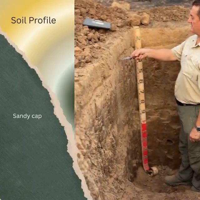
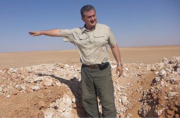
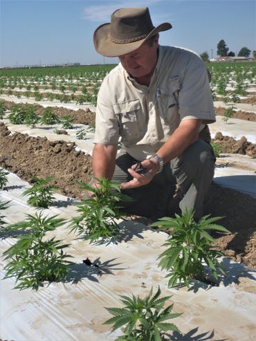
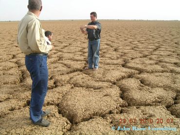
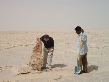
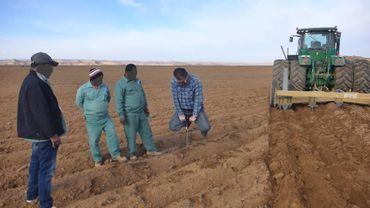
John is a soil enthusiast with more than 45 years of field experience, having examined thousands of soil profiles and surveyed around 3 million hectares across 55 countries.
His approach is simple: prove it in the field. Technology can assist, but the soil profile is the truth. Gadgets may change, but 2 × 2 still equals 4. Instruments must be calibrated to the soil - not the other way around.
John is focused on practical solutions that turn complex soil problems into productive, income-generating land use. That is the core of our service: real soil data, collected on your land, not remotely, not by AI, and not by copy-and-paste assumptions from publications that have no direct relationship to your land.
His motto says it best: Soil does not respond to opinions; it responds to how we manage it. Spare me the rhetoric - prove it in practice.

We are in the commercial soil surveying business. Our purpose is simple: to replace guesswork with evidence, reduce preventable losses, help clients invest in the right soils, and manage land according to what it can genuinely support.
Our maps and reports translate field evidence into plain language for practical decisions. They are not produced to sit on a shelf. They are designed to help clients avoid costly mistakes and make the right decisions before large sums of money are committed.
Your soil already holds the answers. We dig, examine, map, and interpret them through our four-step mapping system.
We determine what soils are present and where they occur.
We identify the limitations that may affect production, irrigation, development and profitability.
We show what can be corrected, improved or managed, and where treatment is required.
We identify the land’s potential after improvement and help clients decide where to invest, what to grow, and which areas require caution.
Basic soil properties, such as morphology, stratification, texture, parent material, and soil depth, can remain relevant for centuries, or even millennia. Dynamic properties, such as compaction, fertility, salinity, permeability, and biological activity, are more strongly influenced by land use and management, and should be reviewed more regularly.
This is why a four-step mapping approach is not a short-term document. When properly conducted, it becomes a long-term foundation for land use planning, investment, and management decisions. It is a once-in-a-lifetime investment in soil knowledge that can outlive any project and pay for itself many times over.

We understand that soil maps and reports based on incorrect field data can cause serious and lasting damage to end users. We therefore do not engage inadequately trained staff to carry out fieldwork, even if their lower hourly rates may appear attractive.
Instead, we roll up our sleeves, get into the soil pits, and do the “dirty” work ourselves. You get what you pay for.
A soil survey by soil profiling can have a usable life of 100 to 200 years or more. Basic soil properties, such as morphology, stratification, texture, cracking, and related features, can remain relevant for centuries or even millennia, and be used and reused countless times without the need to repeat the fieldwork.
In contrast, dynamic properties such as compaction, smearing, fertility, and permeability are more dependent on land management and should be reviewed more frequently.

A Small Cost Before a Major Investment
Agricultural development often demands substantial upfront capital and years of ongoing operating costs. If the soil is unsuitable or its limitations are not properly understood, money can continue to be spent while production and profit fall short of expectations. No amount of infrastructure, technology, or management can fully overcome the wrong soil in the wrong place.
A proper soil survey helps show where investment is justified, and which areas may be better left alone. That is why soil investigation should come before final design, irrigation installation, planting, and any major commitment of money.

The main benefit of our 4-step soil survey mapping system is simple: it helps clients invest in the right soils, for the right purpose, in the right way. Unlike infrastructure, our survey is based on soil profiling, which is not subject to wear and tear. It is not directly affected by changes in climate, markets, pests, diseases, water availability, fertiliser prices, machinery, labour, or chemical inputs. The land may be managed differently over time, but the soil profile remains the foundation of what that land can realistically support.
Our 4-step mapping system is a once-in-a-lifetime investment in soil knowledge. It can outlive any single project and pay for itself many times over by reducing risk, preventing waste, and directing investment towards the soils most capable of delivering a return. Worldwide experience has shown cost-benefit ratios ranging from 1:200 to 1:500 and more. If you already have a soil survey, use it wisely. If not, we can prepare one for you, because it is as important to the success of a land-based enterprise as the foundation is to a skyscraper.
John Rasic’s experience includes some of the world’s largest soil survey, land evaluations, and agricultural development projects, where mistakes are expensive. These projects required practical field investigation, mega-scale soil interpretation, mapping, and clear recommendations for development, helping protect major investments from the ground up.
Countries Where John Has Worked
Algeria, Angola, Argentina, Australia, Azerbaijan, Bosnia and Herzegovina, Brazil, Bulgaria, Cambodia, Chile, Republic of the Congo, Croatia, Democratic Republic of the Congo, Egypt, Eritrea, Ethiopia, Georgia, Gabon, Iraq, Kazakhstan, Kenya, Kyrgyzstan, Liberia, Libya, Mali, Mauritania, Mexico, Mongolia, Morocco, Myanmar, Namibia, New Zealand, Nigeria, North Macedonia, Oman, Qatar, Romania, Russia, Saudi Arabia, Senegal, Serbia, South Sudan, Sudan, Tajikistan, Tanzania, Tunisia, Turkmenistan, Uganda, Ukraine, United Arab Emirates, United States, Uzbekistan, Vanuatu, Vietnam, and Zambia.
Selected project experience includes:
John’s experience speaks for itself:
practical results, a straightforward approach, and a strong track record of transforming difficult land into valuable, productive resources. He provides expert guidance in:
- Soil science, - Irrigation, -Land reclamation, Soil improvement and Agricultural development across a wide range of environments

There is an old proverb I follow closely - Give a man a fish, and you feed him for a day; teach a man to fish, and you feed him for a lifetime - The same principle applies to soil.
Maps and reports are valuable because they help people make better decisions on a specific project. But teaching people how to read and understand their soil gives them something even greater: knowledge they can use again and again, across seasons, properties, projects, continents, and investments.
Our aim is not only to deliver answers. It is to help people understand where those answers come from and build lasting soil intelligence. Because once people learn how to read the soil, they are no longer guessing. They are managing with evidence.
We provide:
• Hands-on One-on-One Training
• Hands-on Group Training
• Virtual One-on-One Training
• Virtual Group Training
• Project Implementation and Supervision
• Management, Monitoring, and Benchmarking


John Rasic is not just a soil consultant; he is a soil healer. With a unique background that bridges old-world agricultural wisdom from his childhood with rigorous scientific training from the University of Novi Sad and Soviet-era research institutions, he brings a perspective that is simply unmatched in the field. He understands that s
John Rasic is not just a soil consultant; he is a soil healer. With a unique background that bridges old-world agricultural wisdom from his childhood with rigorous scientific training from the University of Novi Sad and Soviet-era research institutions, he brings a perspective that is simply unmatched in the field. He understands that soil is the mother of all life, and that by healing the soil, we can create resilient, productive, and profitable agricultural systems.